
Beholder AI Projects Portfolio
Showcases of Our EXPERTISE
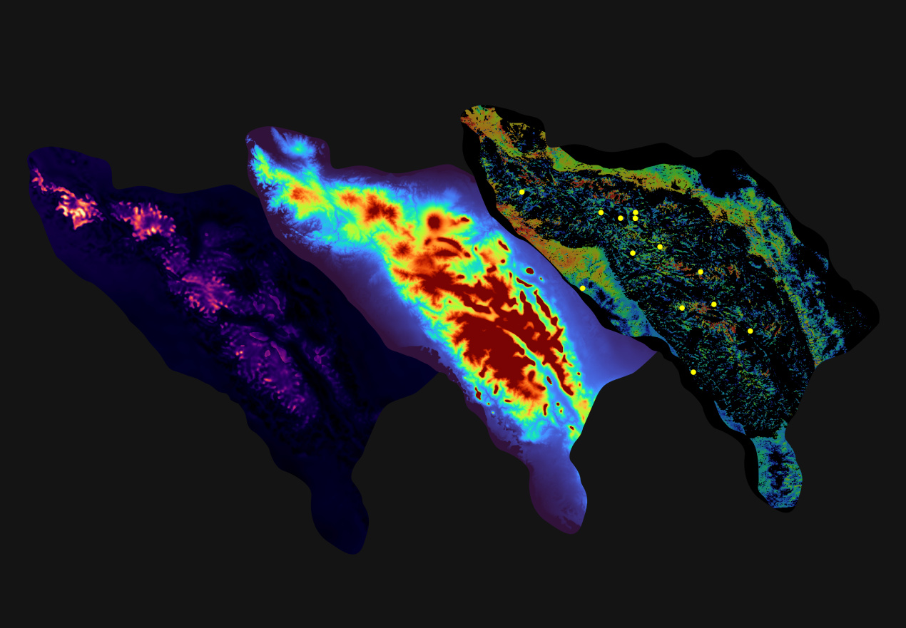
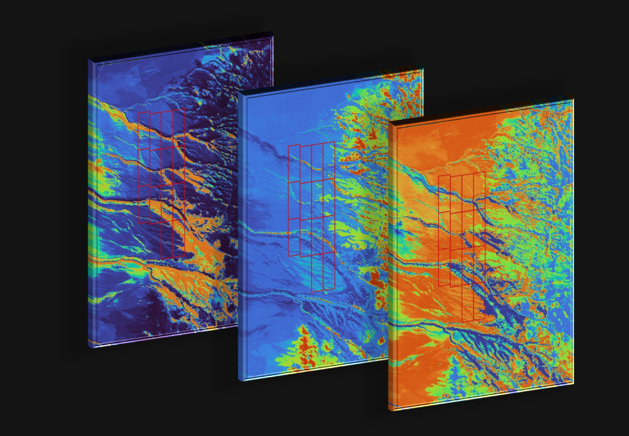
Natron Project, Tanzania
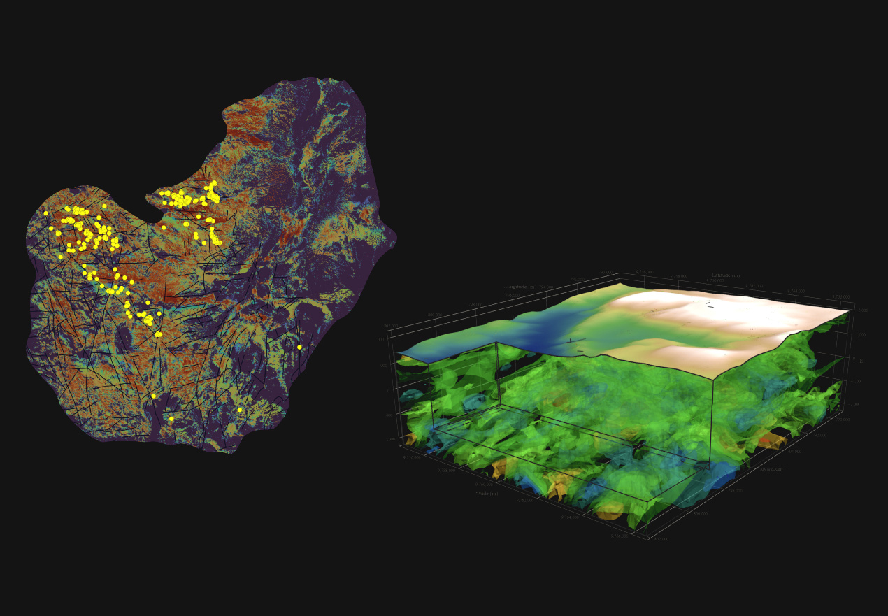
This project focuses on the Lake Natron region in northern Tanzania, an area characterized by complex geological structures and high mineral potential. The region is of particular interest due to the presence of gold, alkaline rocks, feldspar, sodium-rich minerals, and associated elements, including critical raw materials.
Geologically, the area lies within the East African Rift System – one of the most tectonically active zones in the world. It features widespread development of young volcanic and sedimentary formations, as well as deep fault zones that create favorable conditions for hydrothermal fluid circulation and the formation of mineralized systems.
The exploration covers an area of approximately 120 km² and involves the analysis of multispectral satellite imagery (Sentinel-2, ASTER), geophysical data (gravity and magnetometry), digital terrain modeling (SRTM, TPI, TRI), structural and geomorphological mapping, geological data interpretation, and geochemical analysis.
As part of the evaluation process, we employed advanced 2D predictive modeling to delineate areas of interest. In addition, 3D geophysical inversion was carried out to reconstruct the subsurface and assess deep-seated structures potentially associated with mineralization.
As a result of this integrated analysis, several isolated structures with elevated mineralogical potential have been identified, presenting promising targets for more detailed follow-up exploration. The findings demonstrate the effectiveness of the applied methodology and highlight opportunities for scaling the approach to adjacent areas within the rift zone.
Aceh, Northern Sumatra
This project is focused on the assessment of geothermal potential in the Aceh region of northern Sumatra — a tectonically dynamic area located along the active Sunda Arc. The region is characterized by recent volcanic activity, complex fault networks, and elevated heat flow, making it a promising target for geothermal exploration.
The study applied advanced spatial data analysis techniques to identify zones of interest for potential geothermal development. Using remote sensing data, digital elevation models, and structural-geomorphological interpretation, the team assessed surface expressions that may indicate underlying geothermal systems. Key indicators included fault density, lineament intersections, slope anomalies, and proximity to volcanic centers.
A 2D predictive model was developed to highlight zones with elevated geothermal potential. These areas were identified through the integration of geological, topographic, and spatial indices, allowing for the delineation of several priority targets for further investigation.
This project showcases the power of early-stage, data-driven geothermal prospecting in large, complex terrains. It provides a framework for further exploration while minimizing field effort and environmental disturbance in the initial assessment phases.
South Sumatra, Indonesia
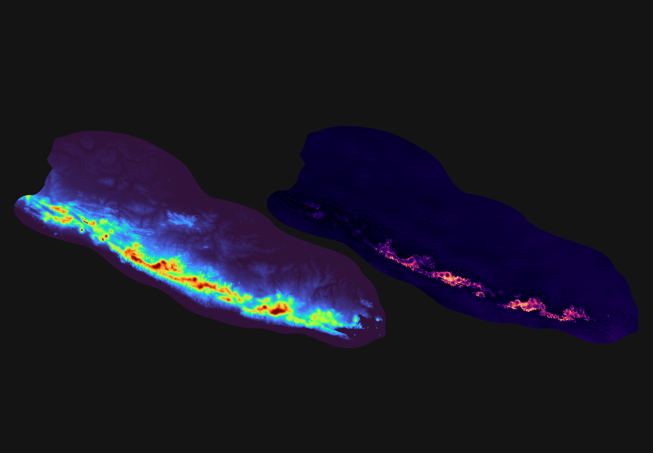
This project focuses on the identification and assessment of geothermal resources in the South Sumatra region of Indonesia. The area lies within a volcanically and tectonically active zone, known for its significant geothermal potential due to the presence of young volcanic formations, deep-seated fault systems, and elevated heat flow.
The study was carried out on a regional scale and aimed at detecting prospective geothermal zones using advanced machine learning techniques. These models were trained to detect subtle spatial patterns associated with geothermal systems, such as proximity to fault zones, volcanic features, and specific geomorphological attributes.
A key outcome of the project was the development of 2D predictive models highlighting zones with elevated geothermal prospectivity. Several such areas were delineated, providing a basis for further detailed investigation and potential future development.
This project demonstrates the effectiveness of data-driven, non-invasive exploration methods for screening large territories in a cost-efficient and environmentally responsible manner. The results serve as a foundation for scaling geothermal assessment activities throughout the wider region of Sumatra.
Kastamonu Province, Turkey
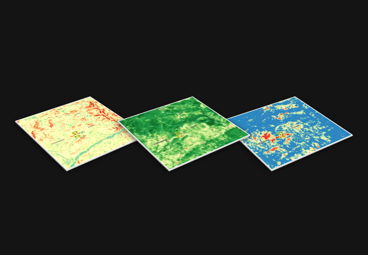
This project focuses on the preliminary evaluation of coalbed methane (CBM) potential in a mountainous region of Kastamonu Province, Turkey. The area is part of the Zonguldak coal basin, which is known for its high-quality hard coal and significant gas adsorption capacity, making it a suitable target for unconventional gas exploration.
The study applied advanced remote sensing and AI-driven analytics to identify surface and subsurface indicators of hydrocarbon microseepage and coalbed-related structures. The workflow included digital elevation modeling, slope classification, vegetation index analysis (NDVI), and microseepage detection based on spectral anomalies and vegetation response patterns.
A deep learning model was developed to assess the spatial probability of gas presence. Most of the terrain was classified as mountainous, which presents both technical challenges and opportunities for focused exploration. The AI system delineated zones of interest based on correlations between microseepage effects, vegetation behavior, and structural terrain features.
Uncertainty estimates were derived through repeated model training, confirming stable predictive performance in the early-stage screening process.
This approach demonstrates the effectiveness of remote, non-invasive techniques for identifying exploration targets in structurally complex environments. The results provide a basis for guiding future field validation and strategic planning in the development of unconventional gas resources.
La Sol Project, Chile
It is focused on the early-stage evaluation of mineralization potential using remote sensing and machine learning methods. The area of interest represents a mountainous terrain with significant spectral and geomorphological contrasts, and evidence of sulfide mineralization zones observed in one of the local gorges.
Initial geochemical correlation analysis revealed strong associations between certain elements (e.g., gold and antimony), although the limited sample distribution introduced spatial bias. To support spatial targeting, the project incorporated Sentinel-2 imagery and SRTM digital elevation models. Key geomorphometric indicators and spectral data were analyzed using principal component analysis (PCA), followed by clustering (K-means) to map spectral lithological variability.
The machine learning workflow included three steps:
- Step 1 (with DEM): A Random Forest classifier was trained using geomorphometric and spectral data to predict three lithological types: intrusive, alteration, and high-sulfidation zones. Terrain-driven bias was observed, with model predictions concentrated in topographic depressions.
- Step 2 (without DEM): To reduce bias, terrain indicators were excluded. This improved model balance, particularly for intrusion and alteration prediction, although sample heterogeneity still limited generalizability.
- Step 3 (seasonal composite): A long-term composite of Sentinel-2 imagery (five summer seasons) was used to improve transferability. Statistical tests confirmed significant spectral differences, which were identified as key predictors.
The results highlight several areas with elevated probability of sulfide mineralization. However, due to spatial bias in sampling, the models require validation through targeted fieldwork. Principal component outputs and spectral zone delineation offer a valuable foundation for planning field investigations and refining remote predictive models
Get in TOUCH
Contact Information
Your email address is safe with us. Required fields are noted with *
Get In Touch
Let us know how we could help.
Email Address:
team@beholder.earth
Address
PAE TN 25-47, LASNAMÄE LINNAOSA, 11414 TALLINN, HARJU MAAKOND